How To Read A Map
“How to read a map?…”, my fellow hiker muttered as he twisted and turned the map this way and that. We hadn’t long started our hike in The Burren. In fact, we had only just left the car. It didn’t fill me with confidence that his map-reading skills weren’t up to scratch, especially since we were going far off the beaten track.
It’s safe to say that we didn’t get too lost that day but, because of this, I’ve decided to write a little guide on how to read a map properly.
Step 1 – Choose The Correct Type Of Map
Step 2 – Understand The Features Of The Map
Step 3 – Put The Map Into Practice
Step 1 – Choose The Correct Type Of Map
There are different types of maps to choose from. You want to be sure that you have the right one for your purpose. A tourist sightseeing map will be of no use to you if you’re in the remote parts of the West Highland Way. Below is a quick list of the types of maps and the situations that they’re useful for.
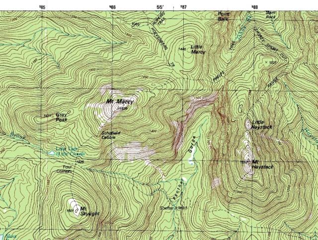
- Topographic Map
- Knowing how to read a map, especially topographic, is the most important thing for hikers. It shows detailed information about the terrain, roads, points of interest and distances.
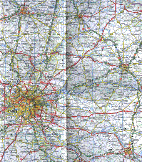
- Road Map
- Road maps are a great accessory to bring on a road trip. They’re very useful if you’re going on a GPS-free trip, however they do often require a passenger to be your map-reader.
- Tourist Map
- A tourist map is useful for city breaks. They generally show the attractions and points of interest around a city. They are usually available in tourist offices or in lobbies of hotels and hostels.
- Choose The Right Scale
- 1:50,000
- The right scale of a map very much depends on what your purpose is. We’ll focus on topographic maps, as this is normally where the scale is important. The most common scale to use while hiking is 1:50,000. This means that for every centimetre on the map, there are 50,000 centimetres (or 500 metres) in real life.
- Maps are broken up into grids, with each box of the grid measuring 2 centimetres. That means for every full box on the map, it covers 1 kilometre in real life. This is useful for quick estimation of distances at a glance.
- 1:25,000
- More detailed maps have a scale of 1:25,000 (1 centimetre = 250 metres in real life). These maps are broken up into grids, with each box of the grid measuring 4 centimeters. That means for every full box on the map, it again covers 1 kilometre in real life.
- These more detailed maps show features such as trees and rocks on the ground.
- 1:50,000
- Legend
- The legend gives a description and guide of the different features and markings on the map.
- Title
- The title of the map tells you what area the map is of.
- Grid References
- A map is broken up into grid boxes, with the first 2 (or 3, depending on accuracy) digits being the x-value, and the last 2 (or again, 3) digits being the y-value. Each grid reference starts with the letter assigned to the map.
- The North Arrow
- This arrow tells you which way is north – it always points to the top of the map.
- Scale
- The scale will tell you what scale your map is – whether it’s 1:25,000 or 1:50,000.
- Spur
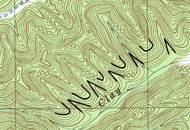
- A spur is recognisable in real-life as a feature that slopes downwards on three sides, and slopes upwards on one. On a map, it looks like this:
-
- The contour lines will point away from the summit of the mountain/hill, indicating a spur.
- Re-Entrant
- A re-entrant is an ‘indentation’ in the side of a mountain and can be identified on a map as contour lines pointing against the natural slope of a mountain. These can also be seen in the above example.
- Saddle
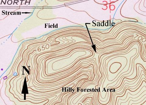
- A saddle can be seen in real-life as a feature that slopes down on two sides, and slopes up on two sides.
- Summit
- The summit of the mountain is the very top and can be identified on a map by a ‘ring contour, seem in the above example.
Step 2 – Understand The Features Of The Map
Knowing the features is important when honing your skills of how to read a map. Listed below are important features of a map and an explanation about them.
Step 3 – Put The Map Into Practice
1. Point Your Map North
To point your map north, place your compass flat on your map, pointing towards the top, and rotate yourself until the compass’ needle points north. Simple!
2. Find Your Location On The Map
Identifying your surroundings and relating them back to your map is the most important thing when trying to locate your position. You usually won’t know your exact grid reference starting out, so a good idea is to start at a grid reference that you do know.
If you began in a town or village and drove to the start of the hike, then start there on your map and re-trace your steps. Once you’re confident that you’re in the correct general area, you can begin to look around for landscape features.
These can be mountains, rivers, walls, spurs, saddles, roads – the list goes on. If you can identify 3 surrounding features in real-life and pinpoint them on your map, you can be quite confident that you have located yourself.
3. Reading Contour Lines
Contour lines are the small black lines that wave around the whole map.
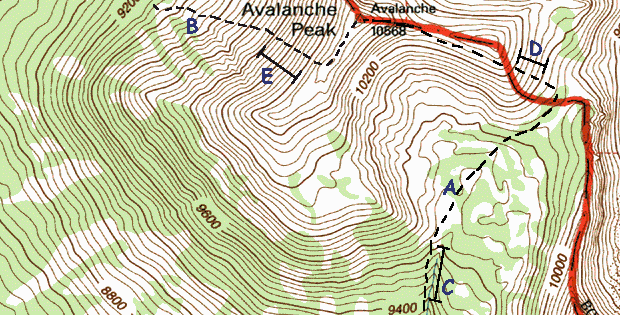
Each contour line on a 1:50,000 scale map represents a rise of 10 metres above sea level. Every 5th contour line will be slightly bolder, to make it easily countable when you’re counting many contours at a time.
The closer the contour lines are together, the steeper the gradient. You can use this information to plan routes on gentler slopes to ease the difficulty of climbing.
4. Identify Features Of The Landscape
5. Thumbing
It’s a useful idea to keep note of your last known location on the map. This is so you can re-trace your steps should you lose your bearings while walking. To do this, place your thumb on your current location on the map, drop it to your side and forget about it.
Next time you look at your map, your thumb will still be on your last location and you can then work out where you are currently.
We hope that you found this map reading guide helpful. When taking a self-guided trip with Hillwalk Tours, in addition to being provided with all necessary maps, we also provide detailed turn-by-turn route notes. The trails we use are also waymarked and we provide a 24/7 on-call support service. If you’re interested in taking a hiking tour, just get in touch with us for further information.
